
Norristown Postal ZIP Coverage
Postal service areas are wider than Norristown borough. The municipal Comprehensive Plan says the local Norristown post office serves several ZIP areas and geography beyond the municipality. The table separates the evidence for postal labels from the Census statistical geography. It does not say that every borough street falls in each entry, that an entry is a neighborhood, or that the county assessor offers a ZIP filter. For a delivery address, use the Postal Service lookup. For borough jurisdiction, use the municipality and parcel fields.
| ZIP | Areas Covered | Post Office | Notes |
|---|---|---|---|
| 19401 | Core Norristown postal label | Norristown Post Office | USPS lists the office at 28 E. Airy Street as 19401-9998; verify each delivery address. |
| 19403 | Norristown postal label reaching surrounding geography | Eagleville Post Office | Its posted street address uses Norristown, PA 19403-9998; the label alone does not establish borough jurisdiction. |
| 19404 | Local county and official mailing usage | Norristown postal service area | The USPS labeling list associates NORRISTOWN PA with 19401 and 19404; confirm delivery or box type for an address. |
| 19488 | Local postal-service geography | Norristown Post Office service area | The municipal plan lists it among local service ZIPs; treat as a postal category until USPS confirms a particular address. |
| 19489 | Local postal-service geography | Norristown Post Office service area | The municipal plan lists it among local service ZIPs; do not attach it to an address without USPS confirmation. |
| 19462 ZCTA | Census profile context | Not a USPS delivery claim | A Census ZIP Code Tabulation Area is statistical geography, not evidence of a borough delivery label. |
This is why a Norristown ZIP code directory must keep postal, municipal, and Census labels apart. A property record may use a borough municipality while USPS uses a city-style delivery label. The difference is not an error to be silently corrected. It is a cue to preserve each source's label and test the exact address in the system that owns the question.
Norristown Postal ZIP Evidence
The Postal Service lists the Norristown Post Office at 28 E. Airy Street with 19401-9998. It also lists the Eagleville Post Office at a Norristown, PA 19403-9998 street address. Those are operational postal listings. They are useful for checking a service label, but neither expands the boundary of Norristown borough. The county property card and the borough's own map tools answer a different geography question.
The Norristown municipal maps page provides local orientation for borough neighborhoods and public geography.
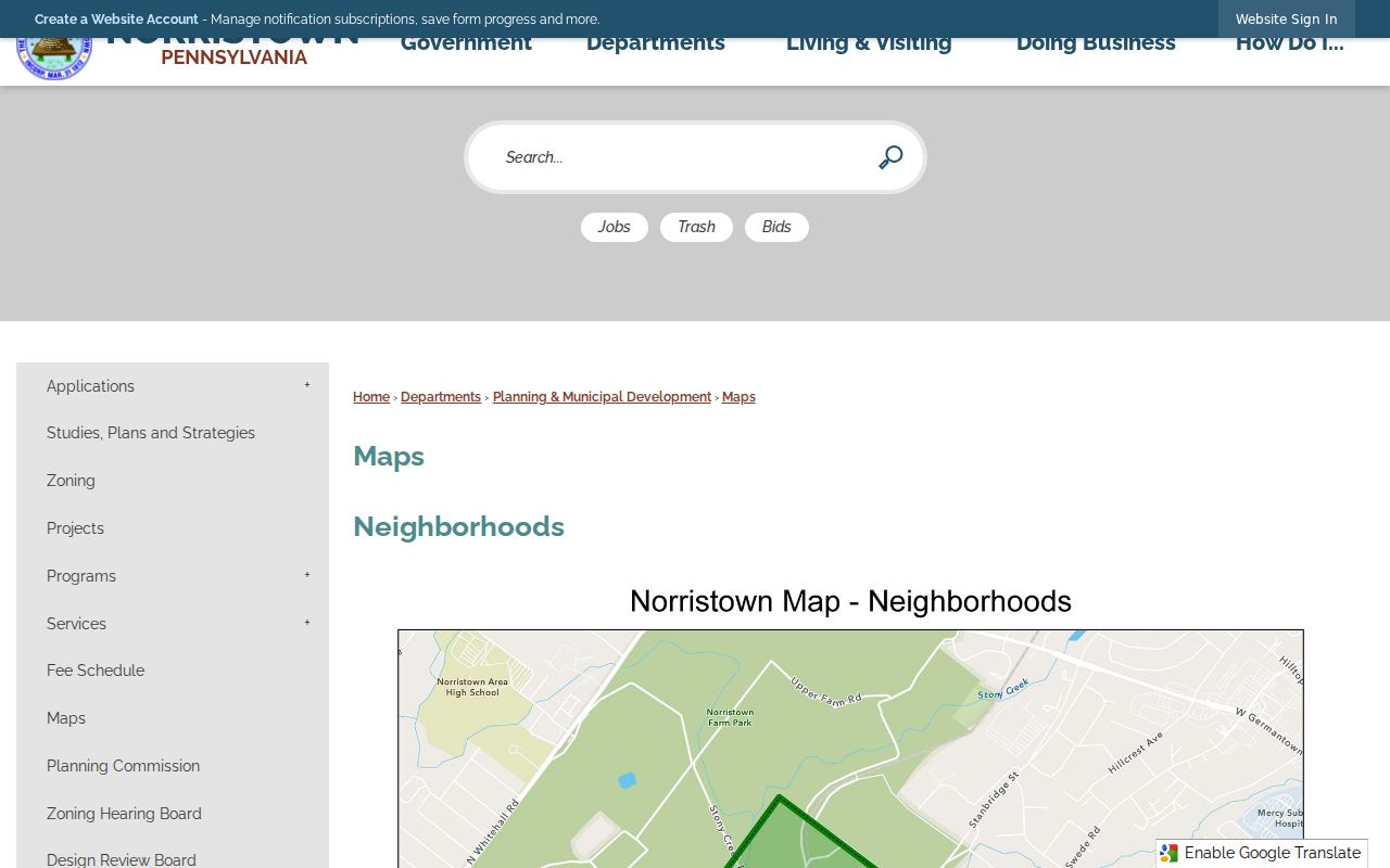
The map helps place an address in municipal context once the parcel field confirms the borough. It does not replace a parcel card, a Postal Service delivery check, or a legal boundary source. That distinction matters when a postal Norristown label crosses into surrounding geography.
Finding Residents by Norristown ZIP
A search within one ZIP should begin with an address, not a sweep of names. The county did not publish or verify a property-record ZIP filter, and the public assessment system is not an owner-name-first directory. Its local address workflow accepts street components and an optional Municipality = NORRISTOWN filter. That is the reliable way to distinguish a borough parcel from a nearby address carrying a similar postal label.
- Use the USPS ZIP Lookup to check the delivery ZIP and preferred city format for the complete address.
- Open Montgomery County Address Search and enter street number, directional part if present, street, suffix, unit, and Municipality = NORRISTOWN when appropriate.
- Open the matching parcel card and preserve the property location, municipality, Tax Map ID or Parid, and the difference between property location and assessment mailing fields.
- Use a dated property, Recorder, municipal, or court record only for its stated purpose. Do not turn an address result into a list of current residents.
For a street-by-street record trail after the borough parcel is clear, the Norristown Street Directory keeps the address, parcel, Recorder, and map steps in their proper order. A ZIP is useful for validating a delivery label; it does not replace the local parcel identifier.
Note: A Postal Service confirmation establishes a deliverable address format, not property jurisdiction, borough membership, or a current household association.
Norristown Property Search Fields
The county Property Records portal is the official property starting point for Norristown. Address Search is the documented local route. The page offers Search by Address, Search by Parcel, Advanced Search, Map Search, and Sales Search, but the county says public assessment searches are by parcel number or street address. Public owner-name searching was removed effective June 17, 2022. No inspected source confirmed a ZIP field, so a ZIP should never be promised as a portal search option.
| Field | Type | Required | Known format or option |
|---|---|---|---|
| Number | Text | Optional | Maximum six characters. |
| Direction | Menu | Optional | Blank, E, N, NE, NW, S, SE, SW, or W. |
| Street | Text | Required | Maximum 20 characters; the portal supports documented wildcard behavior. |
| Suffix | Menu | Optional | Standardized street-type selection. |
| Unit # | Text | Optional | Maximum six characters. |
| Municipality | Filter | Optional | Includes NORRISTOWN. |
The Property Records advanced-search page is one of the portal's separate public modes.
The advanced route exposes criteria such as tax year, permit flag, jurisdiction, block, unit, street and number, stories, bedrooms, bathrooms, living area, sales date or price, land-use code, appraised value, parcel ID, square feet, acres, and neighborhood. The research did not execute its owner criterion or verify it as a working public name route. Results should be treated as informational data, not a title search, survey, appraisal, zoning certification, or permit determination.
Norristown ZIP Map Context
County parcel data and borough maps serve different tasks. After an exact address is normalized, the county parcel card provides the municipality and parcel key. The borough's Service Areas experience can then show a council district, the district council member, street-maintenance route, and street-cleaning day for an entered address. It is a useful civic-geography check. It cannot establish a legal property boundary, title, or private household.
Montgomery County Data and Mapping Services and the county GIS hub also allow users to display, find, and identify county map features. The county describes that geography as informational and not a legal description. Preserve the source and its date with a map result, especially when postal and municipal labels do not match.
Norristown ZIP Boundary Types
A postal label, a municipal limit, and a Census statistical area are drawn for separate purposes. USPS assigns delivery labels and validates a particular mailing address. Norristown borough and Montgomery County maintain civic and parcel geography. The Census uses ZIP Code Tabulation Areas, or ZCTAs, to summarize data. The Census explicitly says ZCTAs are not USPS delivery maps. A borough address can therefore have a postal label that reaches beyond the borough, while a Census profile can include a ZCTA that is not proof of a delivery ZIP.
- ZIP
- A Postal Service routing label used to support delivery. It does not define a borough boundary.
- ZIP+4
- An added delivery segment that makes a ZIP more specific. It is not a municipal identifier.
- PO-box ZIP
- A postal category tied to a box service or postal operation. Verify it for the particular delivery or box arrangement.
- Unique ZIP
- A postal category that can be assigned for a specialized mailing function. Do not infer a neighborhood from it.
- Carrier route
- A delivery-route grouping used by USPS. It is not a legal property, Census, or borough boundary.
The most reliable conflict rule is simple: favor the parcel's displayed municipality and situs when the question is property jurisdiction, keep USPS and historic variants as source labels, and use a ZCTA only for aggregate context. Do not overwrite one geography with another.
Norristown ZIP Geography
Historic context adds another label layer. The Municipal Heritage Plan says the original Town of Norris was bounded by Cherry, Green, Airy, and Lafayette and only partly overlaps the modern historic district. That helps explain why an old directory, map, deed, or census can use a street form that needs careful comparison with a modern parcel. It is not evidence of a borough-wide renumbering or a conversion rule for every address.
The municipality identifies Central Norristown and West Norristown or West End as historic districts with distinct development periods. Their maps describe historic context, not postal delivery, tax, zoning, or household boundaries. Keep a historical street form alongside the current form, note its source and date, and avoid manufacturing a link when the record trail does not support one.
Norristown ZIP Research Limits
A Norristown postal directory should stop at address validity and record geography. Do not treat an assessment mailing field as proof of current residence. Do not merge people on a name, postal label, or shared street alone. The property portal states that data and imagery may not align and that its information is not a substitute for a legal survey or title work. Its property data update weekly, map data daily, and photos quarterly, which makes a source date essential.
Protected and redacted information remains protected even when surrounding geography is public. Pennsylvania's Address Confidentiality Program can provide an approved participant a substitute address for listed government records. Never attempt to replace that address with inferred parcel, court, or mailing data. When an official record is unclear, seek a defined existing document from the right custodian and preserve the limitation rather than guessing.